Eight places, and a 7–10 day sample route for people who like a mystery they can actually visit. Legends are marked as legends. This page does not sell the trip.
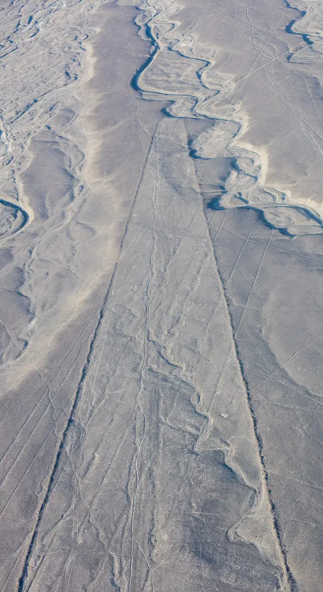
These lines were scratched into the desert of southern Peru between about 500 BC and 500 AD, first by the Paracas and then by the Nazca. Makers removed dark surface stones so the lighter ground showed through. The desert is dry enough that the lines survived.
Archaeologists still debate why. Leading ideas are ritual paths linked to water, which this desert needed, and astronomy, a reading that later surveys challenged. In 2024 a Japanese team working with IBM used AI to scan the area and confirmed 303 new figures on foot, nearly doubling the known count. Many sit beside ancient walking trails. The AI helped spot candidates. People confirmed them. It did not settle what the lines mean.
The figures read best from the air, on a short overflight from Nazca. From the ground, a roadside viewing tower on the Pan-American Highway shows a few.
Marcahuasi
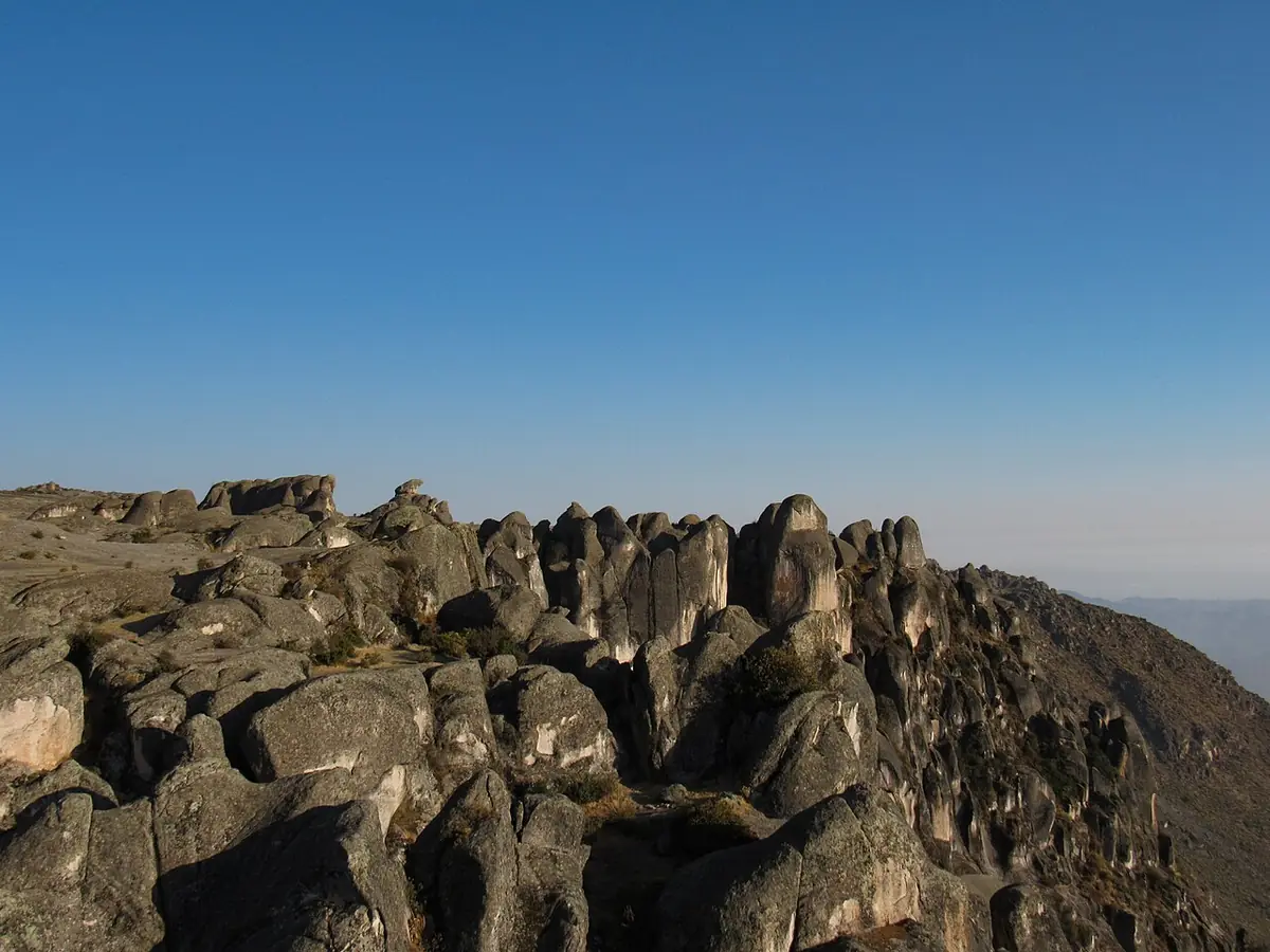
About three hours from Lima, Marcahuasi is a plateau near 4,000 meters, above the village of San Pedro de Casta. Visitors see faces, animals and a rock called the Monument to Humanity.
The legend says an ancient people carved the rocks. Archaeologists say wind, rain and time shaped the granite, and pareidolia does the rest. Real pre-Columbian ruins and tombs are on the plateau too. The land belongs to the community.
Marcahuasi is a separately planned extension, outside the 7–10 day sample route. Allow extra days for gradual acclimatization and consult a qualified travel-health professional before planning this high-altitude visit. The CDC altitude guidance in Sources advises against going from low altitude to a sleeping altitude of 2,750 meters or more in one day; sleeping above 3,400 meters on the first night is high risk. Extra time does not guarantee safety. Register in San Pedro de Casta and hire a local guide.
Willka Uta (Aramu Muru)
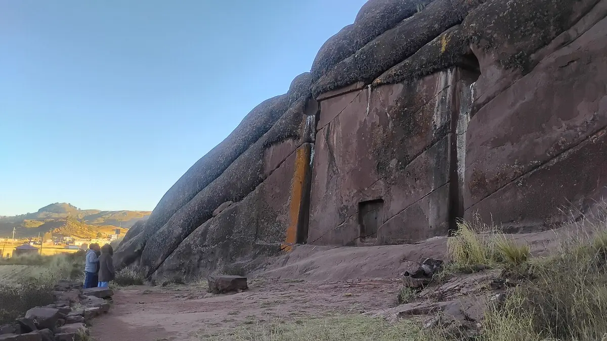
Near Lake Titicaca, south of Puno, a wall about seven meters across is carved into the rock, with a niche about two meters tall at its base. A legend says an Inca priest, fleeing the Spanish with a golden disk, set the disk in the niche, a door opened, and he was never seen again.
That portal story is a legend, not a recorded fact. The name Aramu Muru and the priest story reportedly trace to a 1961 American esoteric book, Secret of the Andes, by George Hunt Williamson. Local Aymara communities know this place by their own names, including Willka Uta, and it is a sacred site. Give ceremonies space. It is listed as a ceremonial archaeological site. No serious excavation has dated it. The leading view is an unfinished ceremonial carving.
It is about 70 kilometers south of Puno, around 3,850 meters. Go with a local guide.
Sacsayhuamán
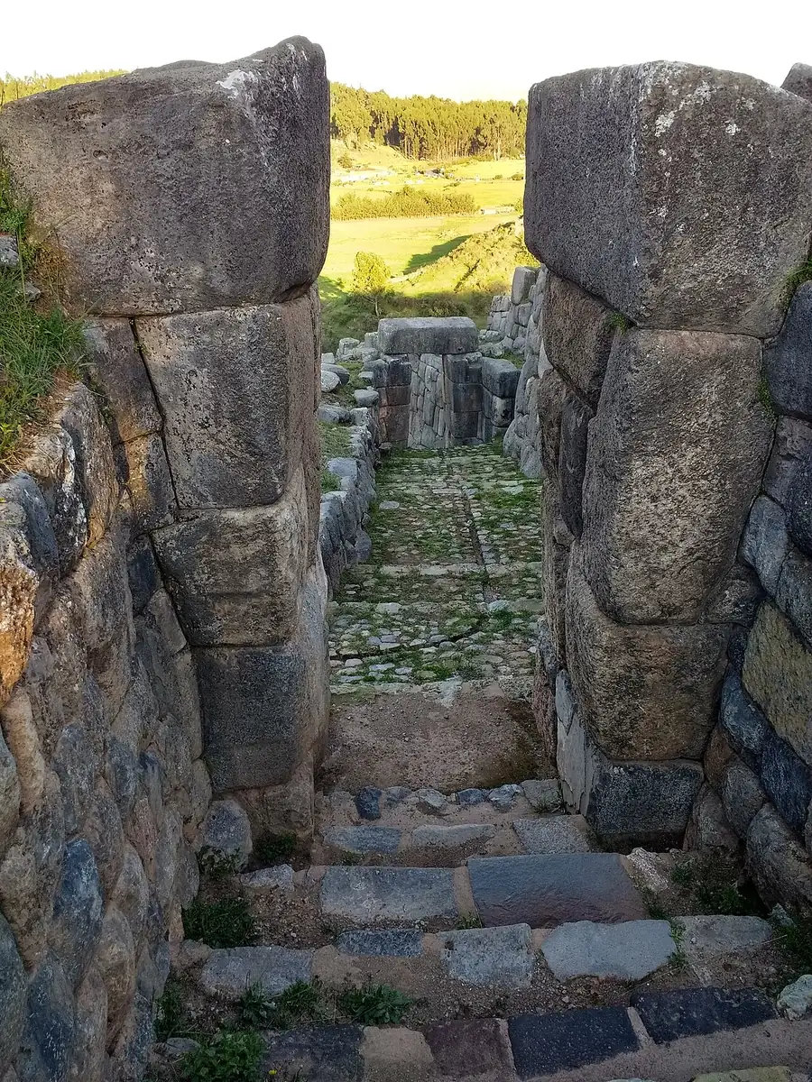
Above Cusco, the Inca built Sacsayhuamán in the 1400s. The walls are dry stone, with no mortar, and a sheet of paper will not fit between many of the stones. The largest blocks are estimated at well over 100 tons.
Jean-Pierre Protzen tested how the fitting was done at an Inca quarry, Rumiqolqa, not at this site. He found river cobbles used as hammers, dressed one face of a block in about 20 minutes, and described a slow trial-and-error fit. Thousands of workers rotated through the job.
The site sits around 3,700 meters, so go after a day in Cusco. On 24 June it hosts Inti Raymi, the Inca sun festival.
Kuélap
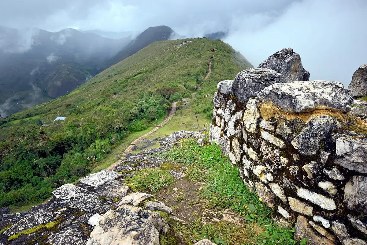
Kuélap is a walled city on a ridge in northern Peru, around 3,000 meters up in the cloud forest. The Chachapoya, called the warriors of the clouds, built walls up to 20 meters high and more than 400 buildings, almost all of them round. They lived here for centuries and were conquered by the Inca in the 1470s, after fierce resistance.
A film once invented a golden “Chachapoyan” idol. The people and the city are real, and only a small share of their sites has been excavated.
Most visitors arrive by cable car. Part of a wall collapsed in 2022. The south wall circuit reopened in June 2026. Check the cable car schedule before you go.
Revash
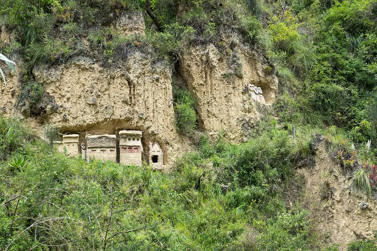
The Chachapoya buried some of their elite at Revash: small painted tombs built into a cliff, shaped like houses, a little like a village on the rock. They stand around 2,800 meters in the Santo Tomás district of Luya.
Revash is the add-on to Kuélap when you have the extra days in the north. Access changes, so check locally before you go.
Lima at night: Casa Matusita
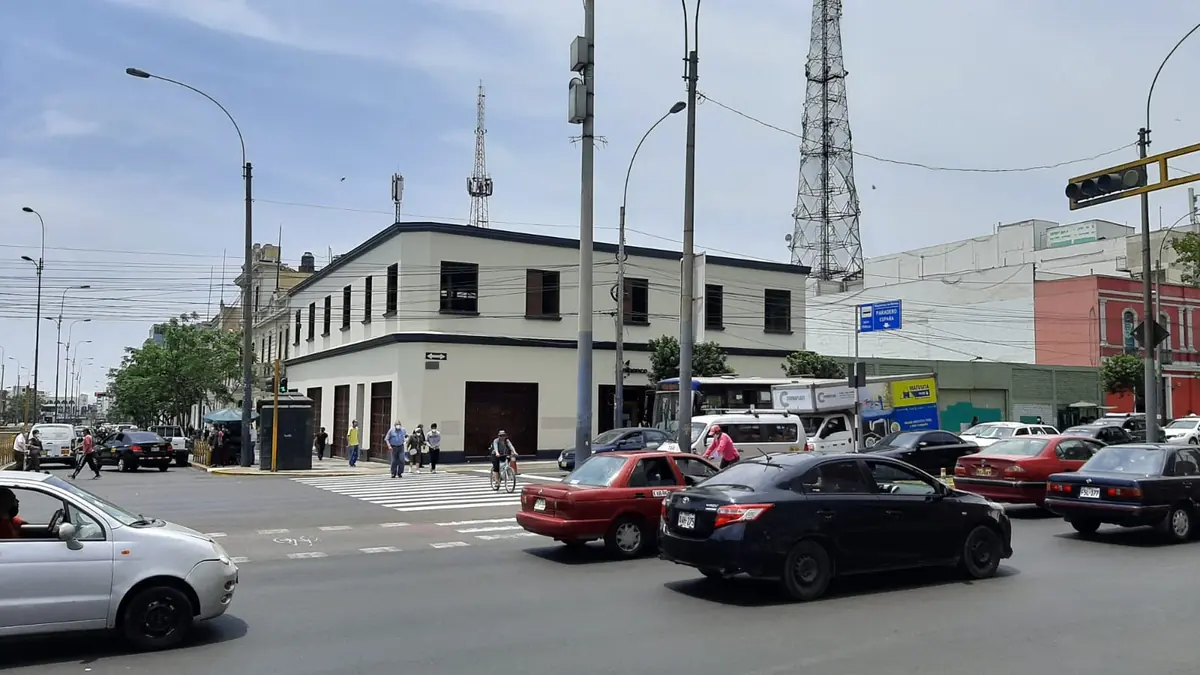
Casa Matusita stands in downtown Lima, at the corner of Garcilaso de la Vega and España, across from where the US Embassy used to be. It was built in 1909. The name comes from a hardware store that used the ground floor for decades.
The legends tell of a woman burned by the Inquisition, a family poisoning, and a TV host who supposedly fled after two hours and ended up in a psychiatric hospital. That host later wrote that it never happened: he wanted ratings. Another theory says the ghost stories kept spies away because of the embassy across the street. Nobody has proved that one. The house is private. You see it from the street. The photograph here is the façade in daylight.
A night walk, the tour del miedo, meets at the Casa Matusita corner and goes on to Presbítero Maestro, a cemetery opened in 1808. The tour is listed in Spanish and recommended for adults. These are real graves. Be respectful.
Stay outside the house. If you join the night tour, treat the cemetery as a burial ground, not a set.
Lake Titicaca
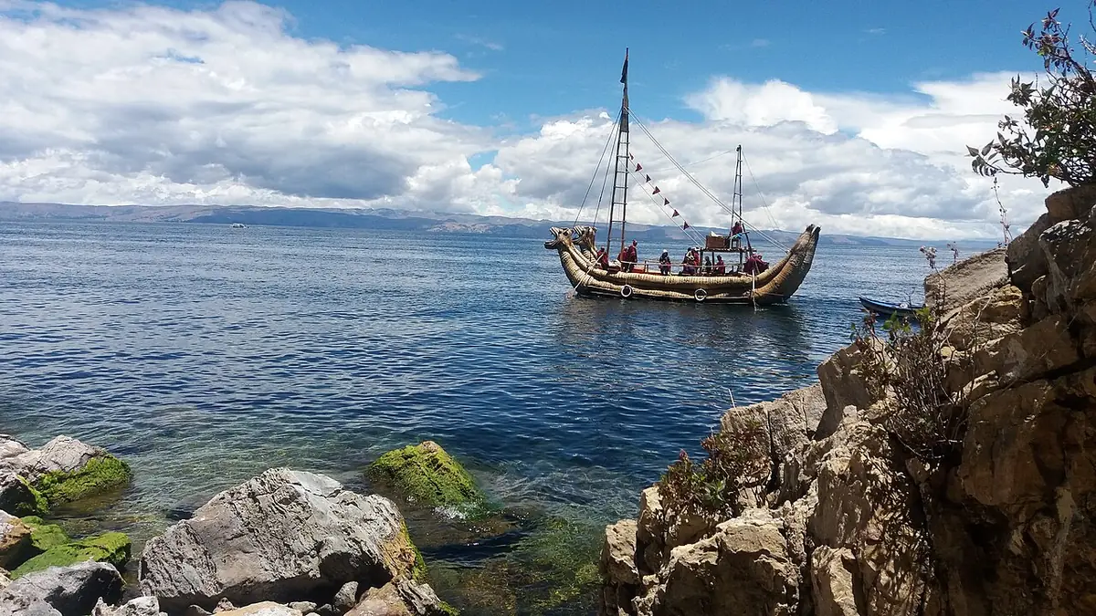
The Inca said their first king rose from this lake. Titicaca lies between Peru and Bolivia at about 3,800 meters, and is often called the highest navigable lake in the world.
One myth, recorded by the Spanish chronicler Juan de Betanzos, says the creator Viracocha rose from the lake in darkness and made the sun, the moon and the stars. Another, written by Inca Garcilaso de la Vega in 1609, says the Sun sent his children, Manco Cápac and Mama Ocllo, out of the lake with a golden staff, and they founded Cusco where it sank. Historians still debate whether Manco Cápac was a real person. Both accounts are myths.
Isla del Sol is on the Bolivian side, so bring a passport. From Puno, the Uros islands and Taquile are run by local communities. Puno is high: rest on the first day.
A 7–10 day sample route
An example, not a Kusi product. Climb in altitude gradually, Cusco before Puno, and hire local guides at community sites. Travel time between stops is left to the planner.
Days 1–2 · LimaCasa Matusita from the street, and the night walk to the Presbítero Maestro cemetery, opened in 1808.
Days 3–5 · NazcaThe road south from Lima on day 3, then an overflight of lines drawn about 2,000 years ago, or the roadside tower if you stay on the ground.
Days 6–7 · CuscoSacsayhuamán’s mortarless walls. Rest first. The site is around 3,700 meters.
Days 8–10 · Puno and Lake TiticacaThe origin myths of the lake, and Willka Uta. Keep the 1961 portal story as legend, and give the sacred site room.
Three more days · Kuélap and RevashIf you have the time, go north for the walled city and the cliff tombs. Check the cable car schedule.